JACKSONVILLE, Fla. —
Weather Headlines:
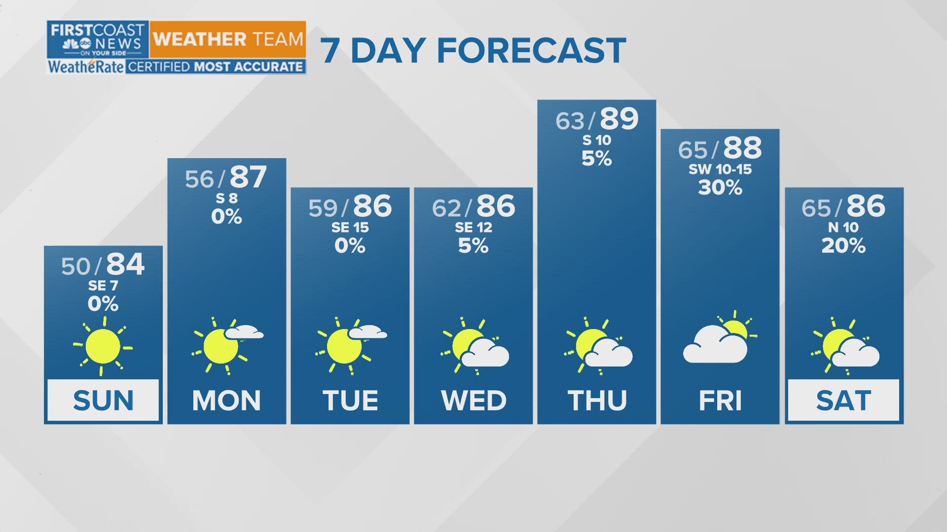
- The very warm and dry pattern continues through the weekend
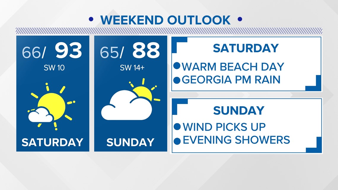
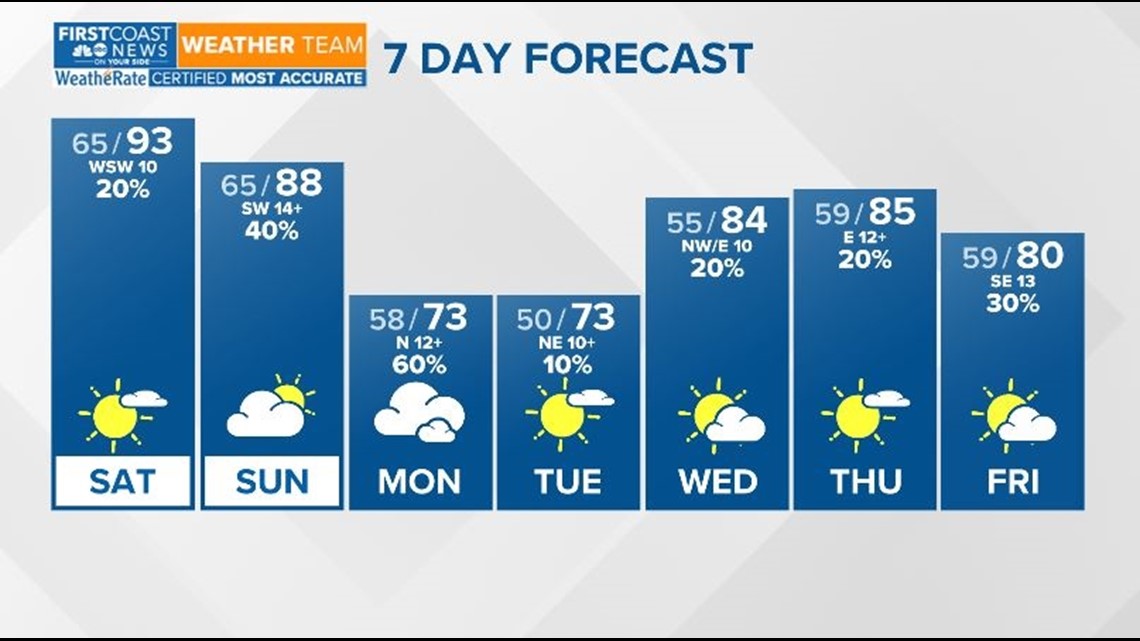
- 90° temperatures continue into Saturday with possible record-breaking highs
- A slow-moving front will trigger showers and storms each afternoon and evening in South Georgia
- Jacksonville's rain chances increase by Sunday evening and Monday morning
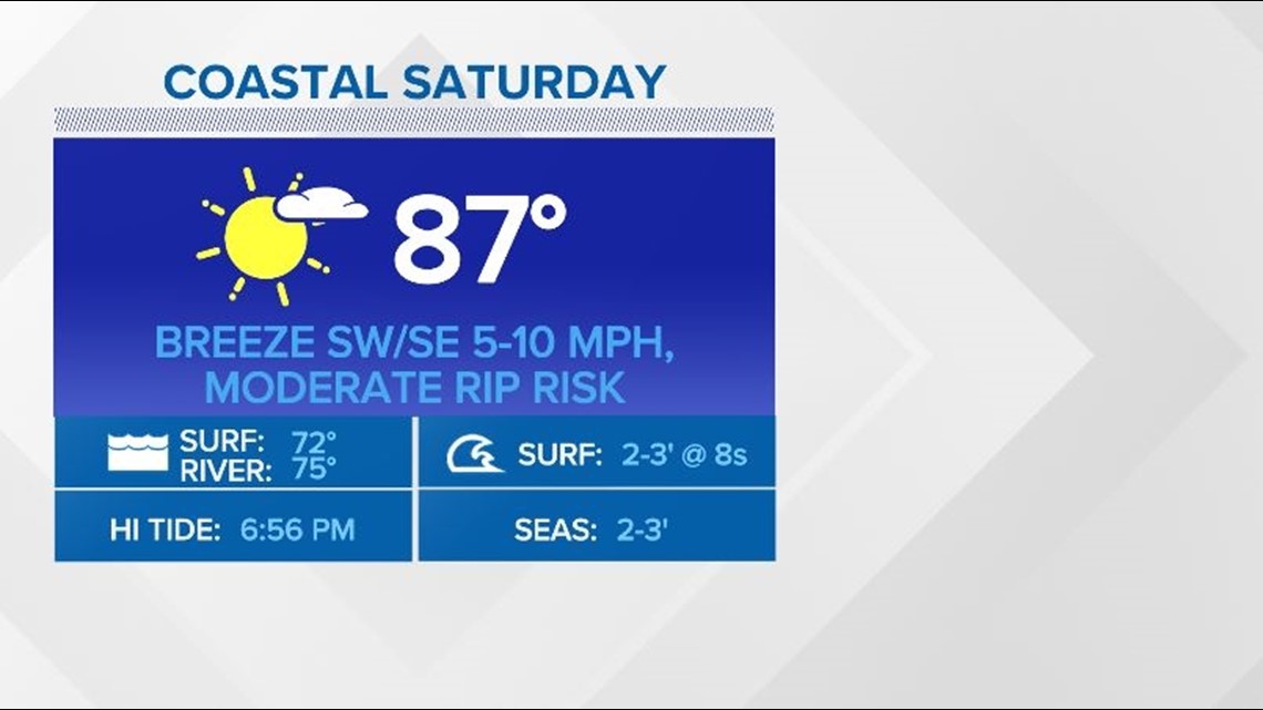
SATURDAY: After hitting 90° on Friday, Saturday will feature our second 90° day with potentially record-breaking highs by the afternoon. The breeze will pick up out of the southwest on Saturday with isolated showers and rumbles possible in south Georgia as a front inches south across the region.
SUNDAY: The warmer-than-normal temperatures continue, but the forecast high drops several degrees below the record high. Expect upper 80s and a breezier southwest wind along with partly sunny skies. Add in a few extra degrees to account for the heat index thanks to the high humidity. Expect only isolated showers chances, mainly across southeast Georgia by late afternoon. Shower and storm chances will climb for north Florida by Sunday evening and overnight.
MONDAY: Showers and a few rumbles of possible are possible through the day with a front in the area. The better rain chance looks to be for the first half of our Monday with clearing conditions by the afternoon and evening. Afternoon temperatures will be cooler, yet more seasonable near 80 degrees to start the workweek.
TUESDAY: 'Cooler' temperatures will be in store for us Tuesday as conditions dry out following Monday's rainfall. But, if you look at the forecast compared to average temperatures, it'll feel more like classic late April weather and the 70s won't last long.
WEDNESDAY - THURSDAY: The mercury rebounds mid-week as high pressure sets up again allowing temperatures to climb back into the high 80s. An onshore wind flow combined with the sea breeze will create the risk of a few isolated afternoon showers but nothing widespread.


Rip currents are a risk we see all year round here across our southeast Georgia and northeast Florida coasts. Know what they are and how to escape them if you ever find yourself caught in a rip current.
Download the First Coast News app and sign up for severe weather alerts.