
JACKSONVILLE, Fla. —
Weather Headlines:
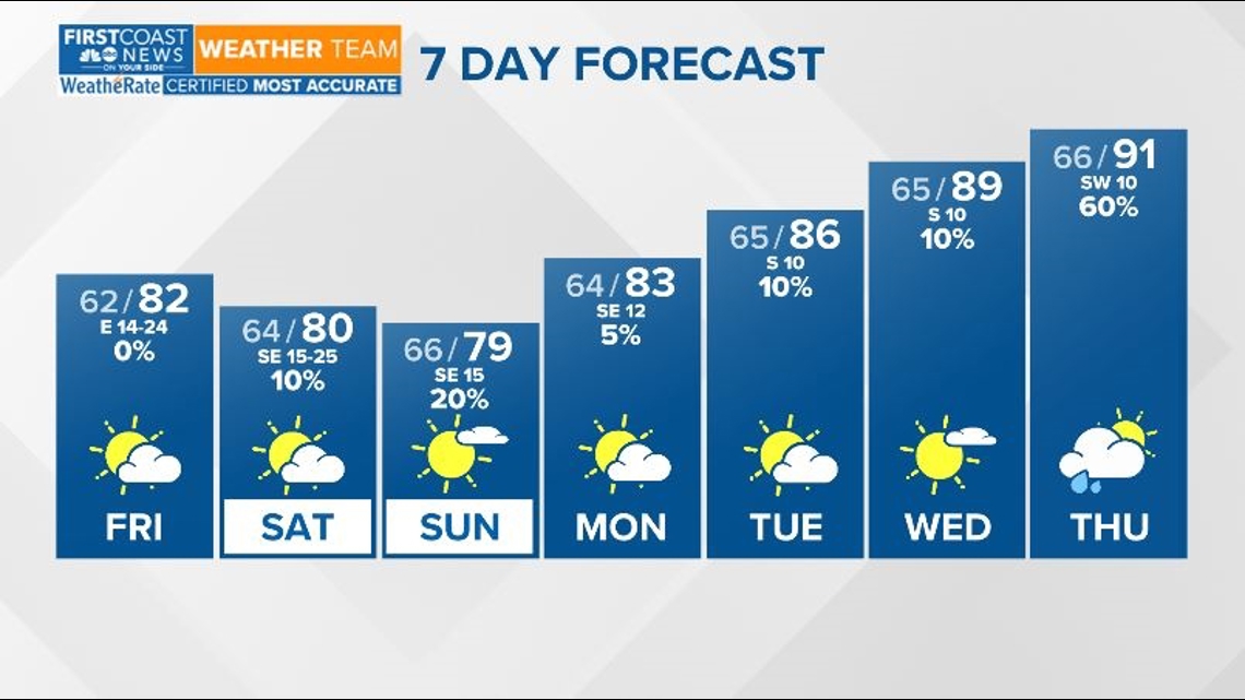
- Dry weather to wrap up the work week.
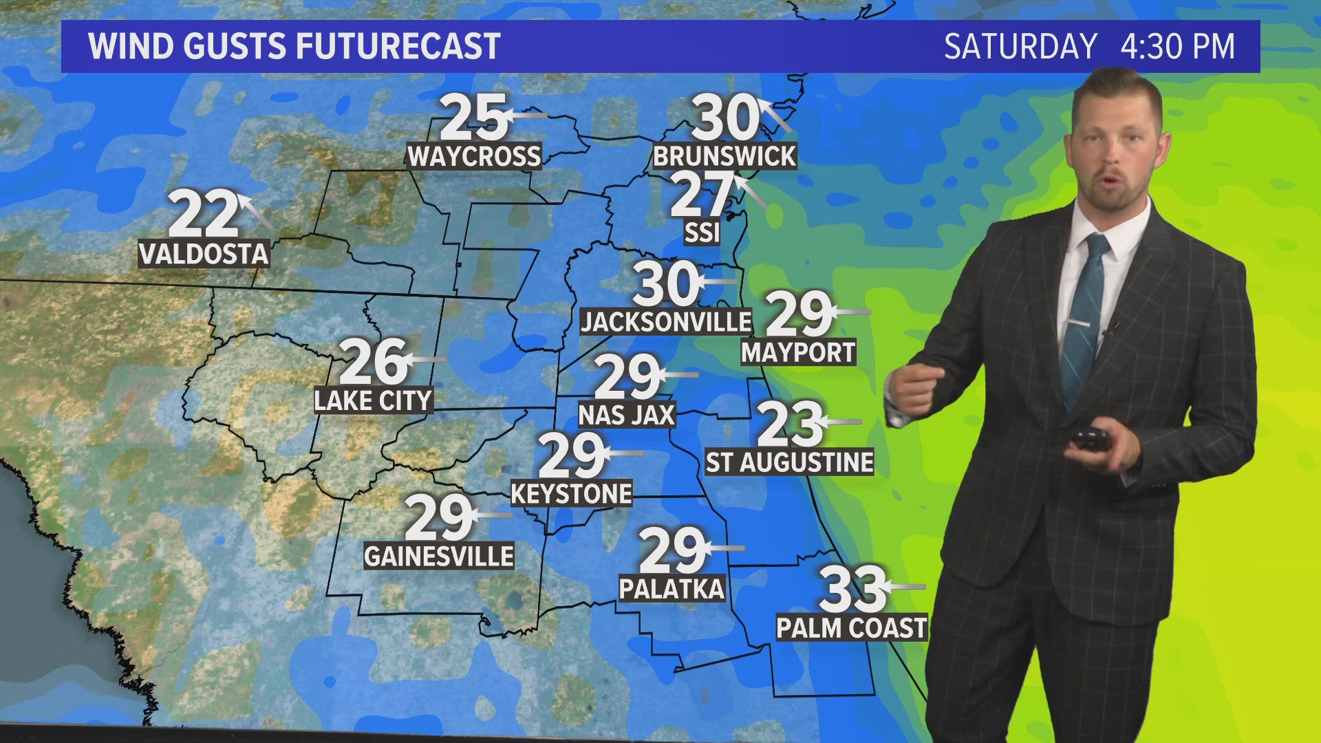
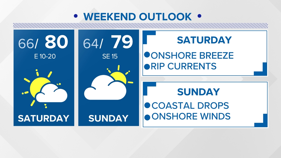
- A stronger onshore flow develops and persists through the weekend. With that a few clouds near the coast could bring some light rain mostly south of Jacksonville.
- Temperatures rebound to above-average levels through next week.
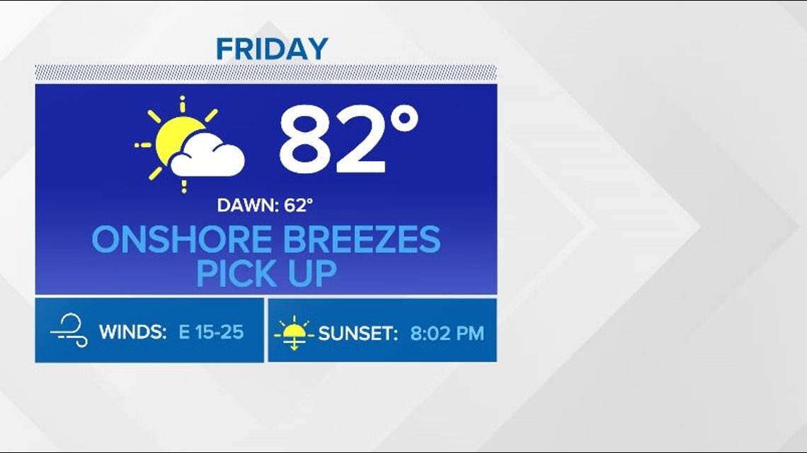
FRIDAY - SUNDAY: A persistent onshore, southeast flow will help to usher in isolated showers near the coast, but most of the rain will remain offshore. Otherwise, conditions will remain mostly dry with highs in the seasonable lower 80s with partly sunny skies. Sunday's high will struggle to get into the 80s but the mercury will rise through next week.
MONDAY - WEDNESDAY: Expect a gradual warmup as southerly winds dominate with passing clouds through the start of the work week. Temperatures could near 90 by Wednesday.


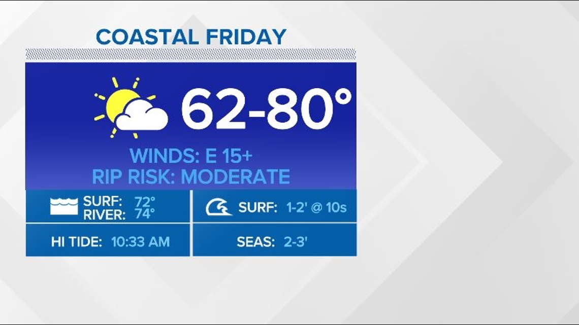


Rip currents are a risk we see all year round here across our southeast Georgia and northeast Florida coasts. Know what they are and how to escape them if you ever find yourself caught in a rip current.
Download the First Coast News app and sign up for severe weather alerts.