

JACKSONVILLE, Fla. —
Weather Headlines:
- The warm and dry pattern continues for the next several days
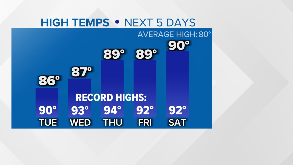
- Just how warm? Afternoon temperatures will hover just below record highs all week
- Jacksonville's average first 90-degree day is April 29
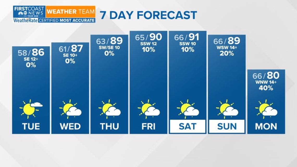
TUESDAY - WEDNESDAY: High temperatures will be in the middle to upper 80s. This is much warmer than normal, as we usually see afternoon temperatures around 80 degrees this time of year. However, temperatures would have to exceed 90 degrees to be record-breaking in the week ahead. Skies will stay mostly sunny and dry. A few clouds move in through the day on Tuesday, but conditions clear by sunset. Patchy fog will develop overnight with some areas of lower visibility by Wednesday morning.
THURSDAY - SUNDAY: High pressure will slide away from our area. Conditions should remain mostly dry, but some isolated showers and storms could be rolling in from the north. Rain chances look highest on Sunday, but still low around 20 to 40 percent. Highs stay quite warm with Jacksonville's first 90-degree day of the year possible!


Rip currents are a risk we see all year round here across our southeast Georgia and northeast Florida coasts. Know what they are and how to escape them if you ever find yourself caught in a rip current.
Download the First Coast News app and sign up for severe weather alerts.